Walk 6 of the Leicestershire Round would take us steadily downhill towards the river Welland. Offering us views into Northamptonshire. We set off from Hallaton.

In front of us as we left the village was the impressive earthwork of Hallaton Castle. This 12th Century motte and bailey castle, built during the reign of King Stephen is thought to have been built as a display of wealth rather than a serious defensive stronghold. The earth works are clearly visible ahead as you pass the cemetery.

The path climbs up over a north bluff of the River Welland until at its top you begin to get a view forwards towards the rest of the days walk. From this spot we got our first view of Langton Caudle. This 147m hill stands alone and offers fantastic views over this part of Leicestershire, which I will talk about in a minute.

Before you get to Langton Caudle you cross the route of the roman road known as the Gartree Road. This ancient road linked Leicester to Cambridge. In the field itself there really isn't any sign of it, though you can make out its course on Google Earth.

The path climbs up the Caudle on its north side. The view opens out at the summit.
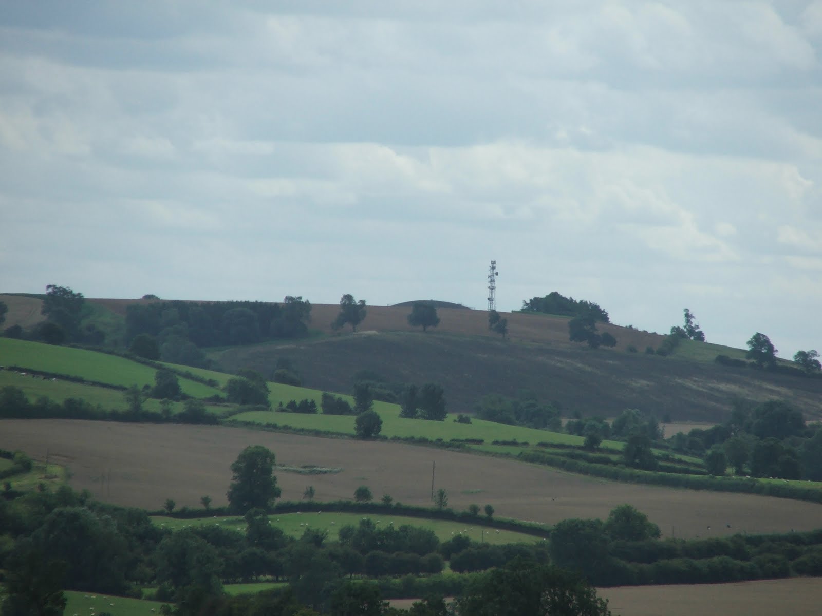
 From the top of the Caudle my attention was drawn in the first instance towards the north. The distinctive domed reservoir atop of Whatborough Hill just visible above a foreground ridge.
 To the east we could see the dramatic sweeping side of the Welland Valley as it curves north eastwards. The River Welland marks the boundary between Leicestershire and Northamptonshire. The far bank of the Welland Valley is therefore across the boarder.
A close up of the Welland Valley shows Cottingham Church spire on the right and Rockingham Castle on the left.

Further around to the south Market Harborough can be seen quite clearly.
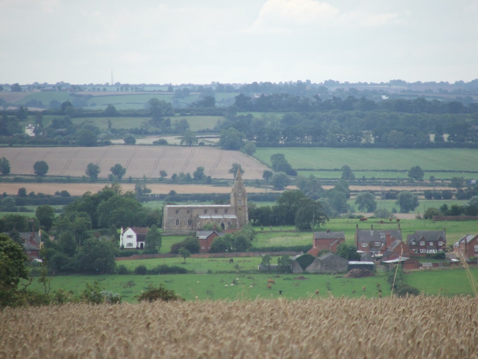
In the near-ground the church at Thorpe Langton sits resplendent in the valley.

Towards the south the green tree covered hill left of centre in this picture is Sibbertoft Wood, in Northamptonshire.

Further west of that the ridge gains a set of distinctive spinneys. This is Hothorpe Hills in Northamptonshire. The white building in front of that is a prison on Gallow Field Road. How apt.

To the west the Church at Church Langton is clearly visible. Behind it Smeeton Hill. On the next walk we will be walking over Smeeton Hill.
 After peering at distant hill for a while we then began the descent towards Thorpe Langton. This part of Leicestershire is pasture and we encountered several bulls on our travels.
From Thorpe Langton the Langton Caudle looks nothing more than a slight hill to the north.

Thorpe Langton cows.

After leaving Thorpe Langton and passing through East Langton we ended up in the Welland flood plain. We crossed several streams that drain into the Welland and they were all swollen with the recent rain we have enjoyed. A quick look over to the west reveals Gumley, our destination on this walk.

Also visible is the church at Foxton. The famous locks of Foxton are not visible from this angle.

The path then led under the railway and across the A6. Another daring road crossing required!

The season is really mature now and the crops in all the fields are ready for harvest. This Oil Seed Rape was being harvested whilst we were there.

Upon getting to Foxton we then followed the canal. The late afternoon sunshine made this last bit really tranquil.
 The Locks at Foxton are worth seeing. We rested here in the pub on the left. Both pubs are nice, but I prefer the local Langton Ales that the other pub has on tap.
The locks are always busy with boat people and tourists.

A short way down the canal we crossed over this bridge into a few more paddocks.

At the end of a long days walking finding the car and sitting down with a flask of tea was a luxury!